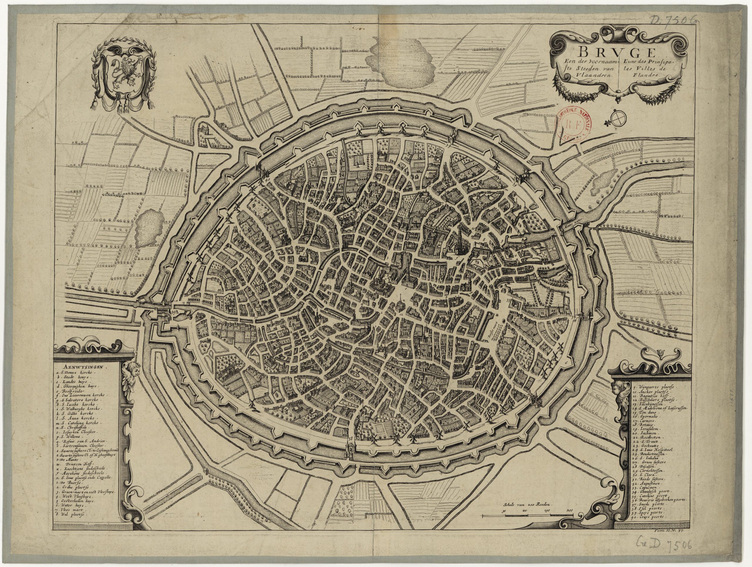
From the end of the 16th century, city maps were first published in the Netherlands, which were based on reliable surveys and therefore provided a much more realistic representation. In addition, a more detailed map could be made with the copper engraving technique, which was not possible with the woodcut technique.
In the 17th century many mapmakers lived in the Netherlands, who could earn a good living thanks to the growing trading power of the province of Holland. Maps were not only made of the Netherlands, but also of countries and areas with which trade was conducted. The maps were often coloured by so-called afsetters (colourists), which increased the realism and legibility of the maps.
City officials in the Netherlands commissioned mapmakers to draw up a map of their city. In those days, such maps were a mean of putting the city in the spotlight, a PR instrument avant la lettre.
The cards appeared in a limited edition and were not intended for the general public. At auctions these days, prices can run up to hundreds of euros depending on the period in which they were made and its size and quality. But there are also reproductions of these historically coloured maps available that are not that expensive.
The city maps in the archives are almost all digitized and can be downloaded in high resolution for free (public domain). This has created the option of recolouring the maps originally printed in black and white. But then digitally.


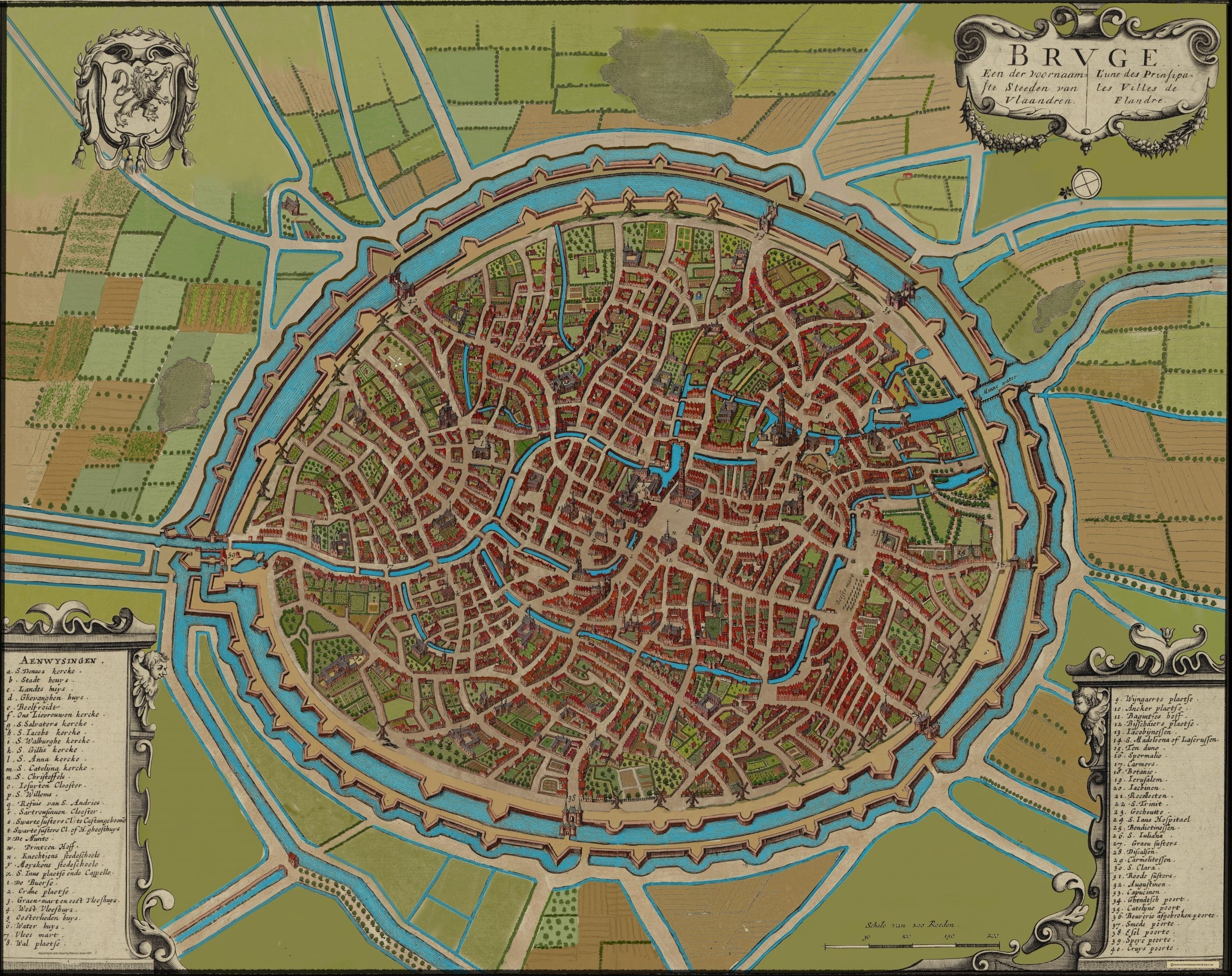
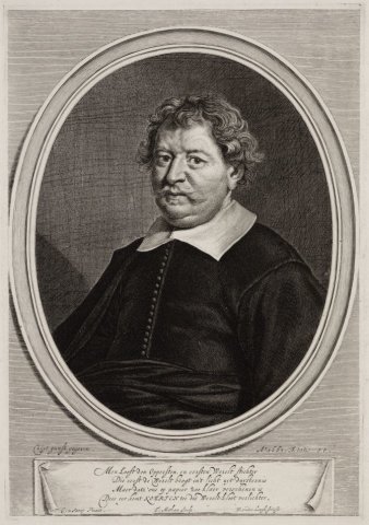
In the past, the afsetter coloured in the maps. These were craftsmen who applied the colours with watercolour and a brush for a few cents. Only a few of them could earn a decent living, such as Frans Koerten (1603-1668) who lived on the Rozengracht in Amsterdam. He’s the only afsetter we know what he looked like.
The colour palette that was common in the 17th and 18th centuries can now be experienced as dull and subdued. The colouring of maps was in some cases done in a somewhat impressionistic way, that is one did not always stay within the lines. A red strip of paint over the roofs and a green strip over a row of trees was enough to create the desired suggestion.
The colours used for the new full colour maps are brighter and more pronounced. The use of multiple shades creates a varied image. The maps are coloured manually and very accurately with a digital brush or pencil, resulting in great readability and experiential value.
My interest in the development of urban and landscape structures has been the basis for colouring historical city maps. The immediate cause was the discovery on the internet of a city map from 1600 of Leiden. This one was made by Pieter Bast.
Pieter Bast (ca. 1550-1603) was one of the first mapmakers to use copper engraving instead of woodcut. In addition, he was assisted by professional surveyors who used reliable measuring techniques and instruments. Originally a Fleming, he had ended up in Leiden due to the consequences of the Eighty Years’ War. Bast made a total of five city maps that have a very high quality. Especially the maps of the city of Leiden, Amsterdam and Leeuwarden are of unparalleled accuracy.
At the end of 2019 I started colouring the city map of Leiden by hand as a modern afsetter. The reactions to this map were very positive and that encouraged me to colour in more city maps from other mapmakers, such as Ioannus Blaeu, Jacob de Geijn and Romeijn de Hooghe.
In the years that followed, 30 city maps were coloured: Amsterdam Leeuwarden, Franeker, Middelburg, Schiedam, The Hague, Rotterdam, Culemborg, Haarlem and more. And the colouring still continues!
Marcus Laman, Afsetter
2023

A framed full colour historic citymap looks distinguished and gives a nice appearance in every livingroom, office or hotelroom.
All cards are sold unframed (print-on-demand) and are printed on 120 gr. paper, poster size 50×70 cm or 35×50 cm. For more information: contact & order.
